
text, photos: salma khaled, darius gondor
illustration: blodau peter
cairo city collective — operational unit
> darius gondor — research
> salma khaled — research & cultural insider
> emanuele campagna — visuals & video
> [redacted for security] — architecture
> [redacted for security] — art
> [redacted for security] — sound & music
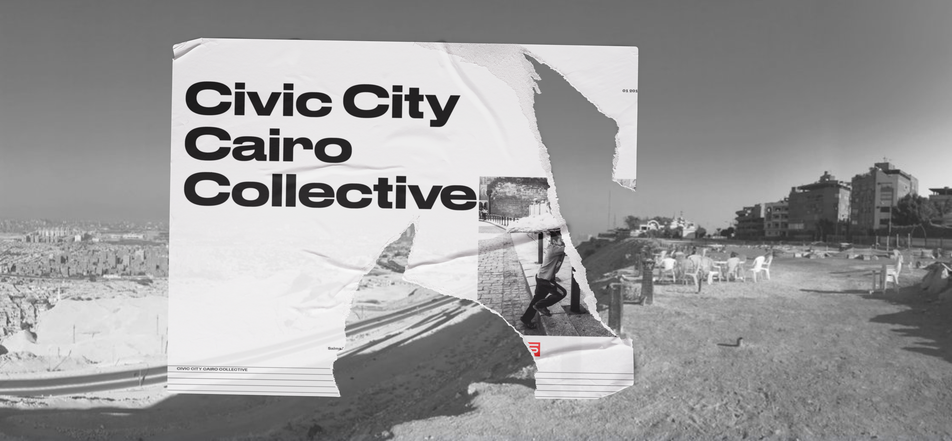
a global directive. initiated by ruedi baur, the "places in relation" framework was established to decode the fragmented spatial realities of modern societies. the operational stage: the centre pompidou in paris.
selected as part of a specialized network of international research groups, we were invited to inject our analytical baseline into the exhibition. the mandate was clear. no theoretical urban planning. instead, a deep dissection of informal architectures and bottom-up structures operating under extreme systemic pressure.
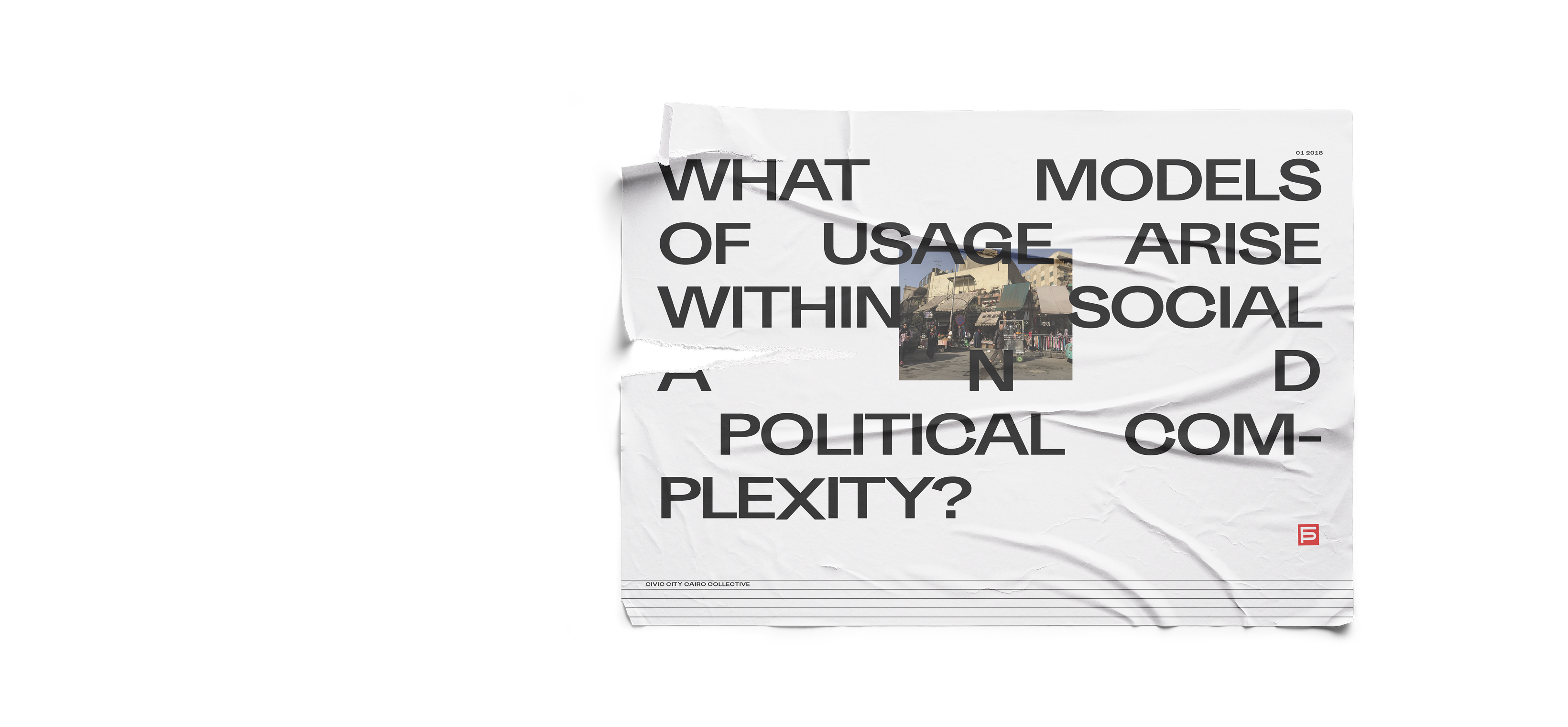
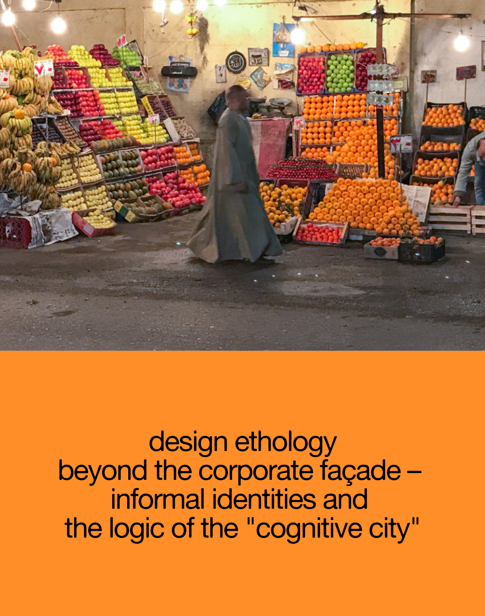
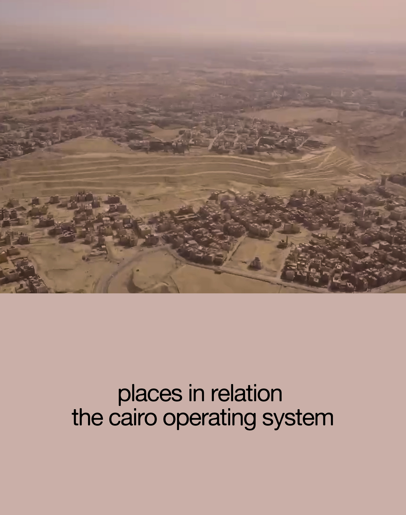
our dedicated research field for this global initiative: the hyper-complex spatial dynamics of cairo.
the local framework conditions formed the absolute baseline of this investigation. to gather valid data within the real urban space, conventional, visible research methodologies were discarded in favor of an adaptive protocol:
the "smart city" concept is a trap. it widens the gap between hyperconnected centers and the periphery, where urbanity dissolves into vague contours. over half of cairo's population exists in conditions that are completely detached from formal urban planning. this reality demands an entirely new spatial strategy.
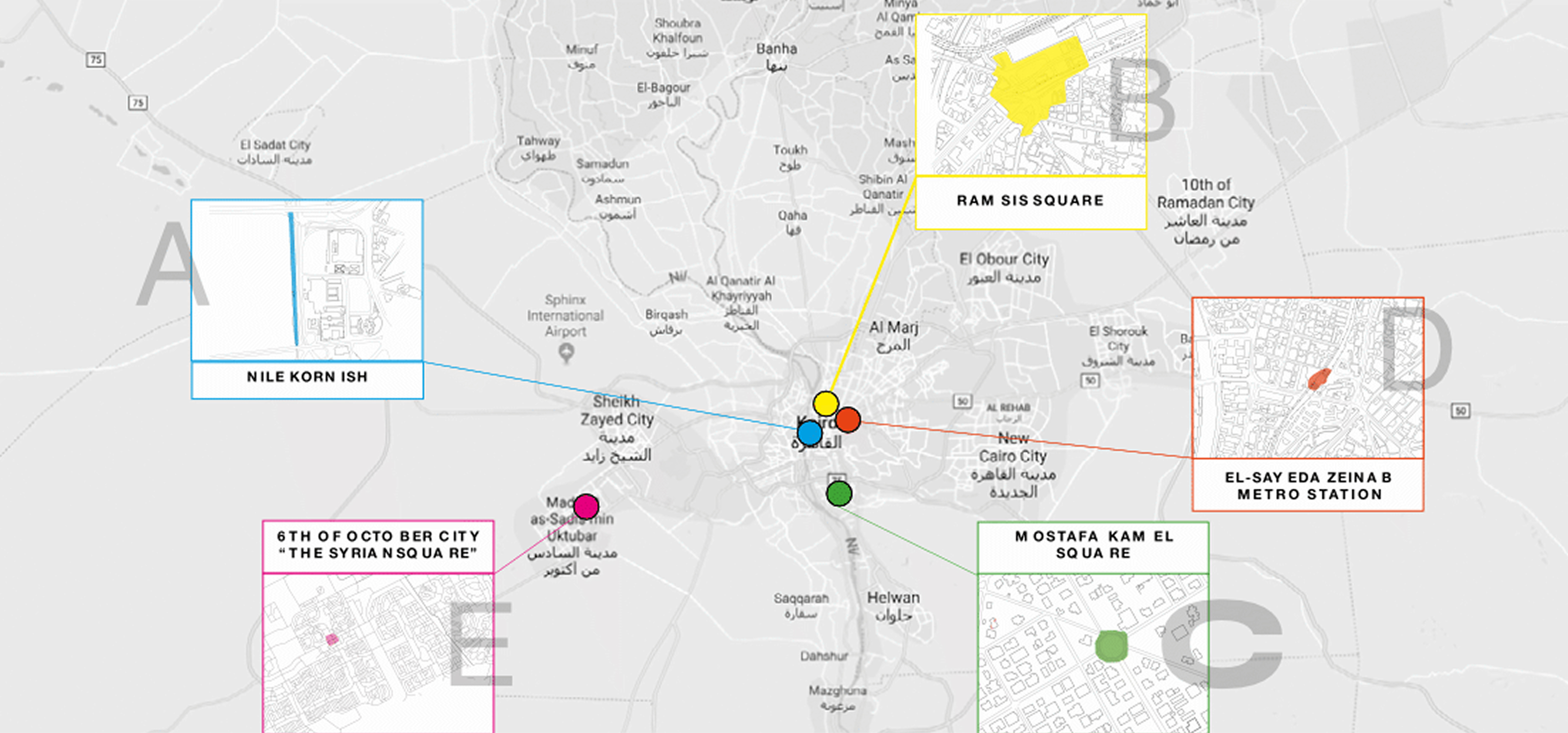
the traditional focus on historic nodes like downtown cairo or tahrir square is obsolete. true urban dynamics happen in the discarded, informal micro-centers that have organically structured their own populations.
to decode this hybrid character, the research isolated five specific locations, selected purely based on their systemic relation to one another.
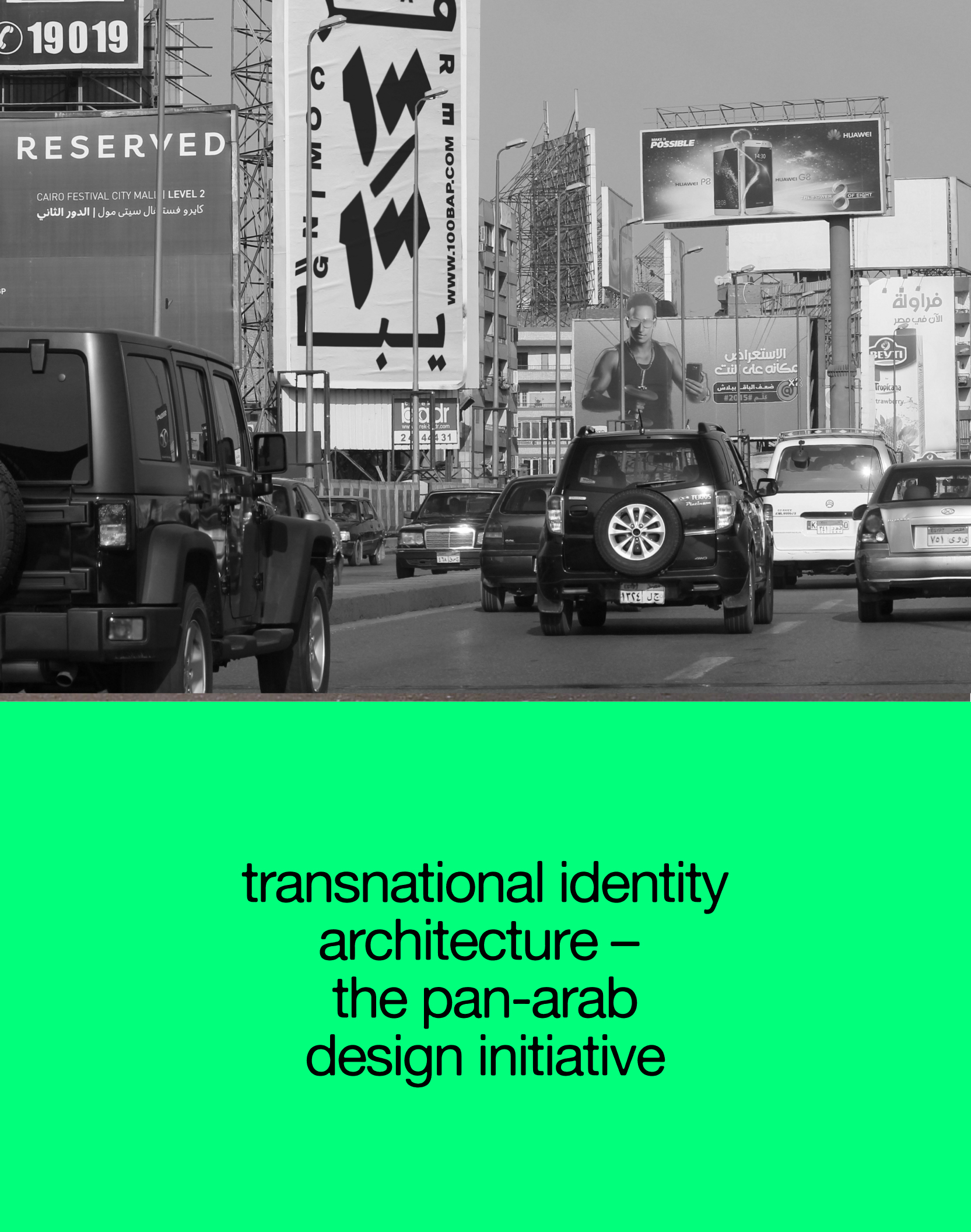
the extreme socioeconomic friction has generated a specific architectural prototype: the segregated green city, engineered on the outskirts. around these artificial utopias, highly functional secondary nodes erupt organically—syrian markets, sports facilities, commercial zones. for every wealthy, isolated center, a parallel, underprivileged center forms its shadow. this continuous human friction is not just a side effect; it is the actual operating system of the city. mapping these informal spaces and exposing their physical exchanges is the baseline for resolving the complexity.
cairo is not a centralized grid. it is a highly complex, decentralized network of autonomous spaces that dictate the survival and culture of specific populations.
map: cairo city collective (cccc)
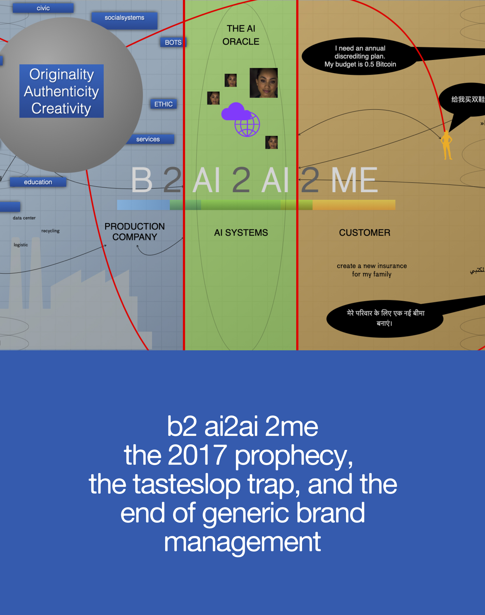
the square functions as a highly sensitive indicator of social stratification. analysis of the usage patterns reveals a fragmented operating mode that fluctuates throughout the day:
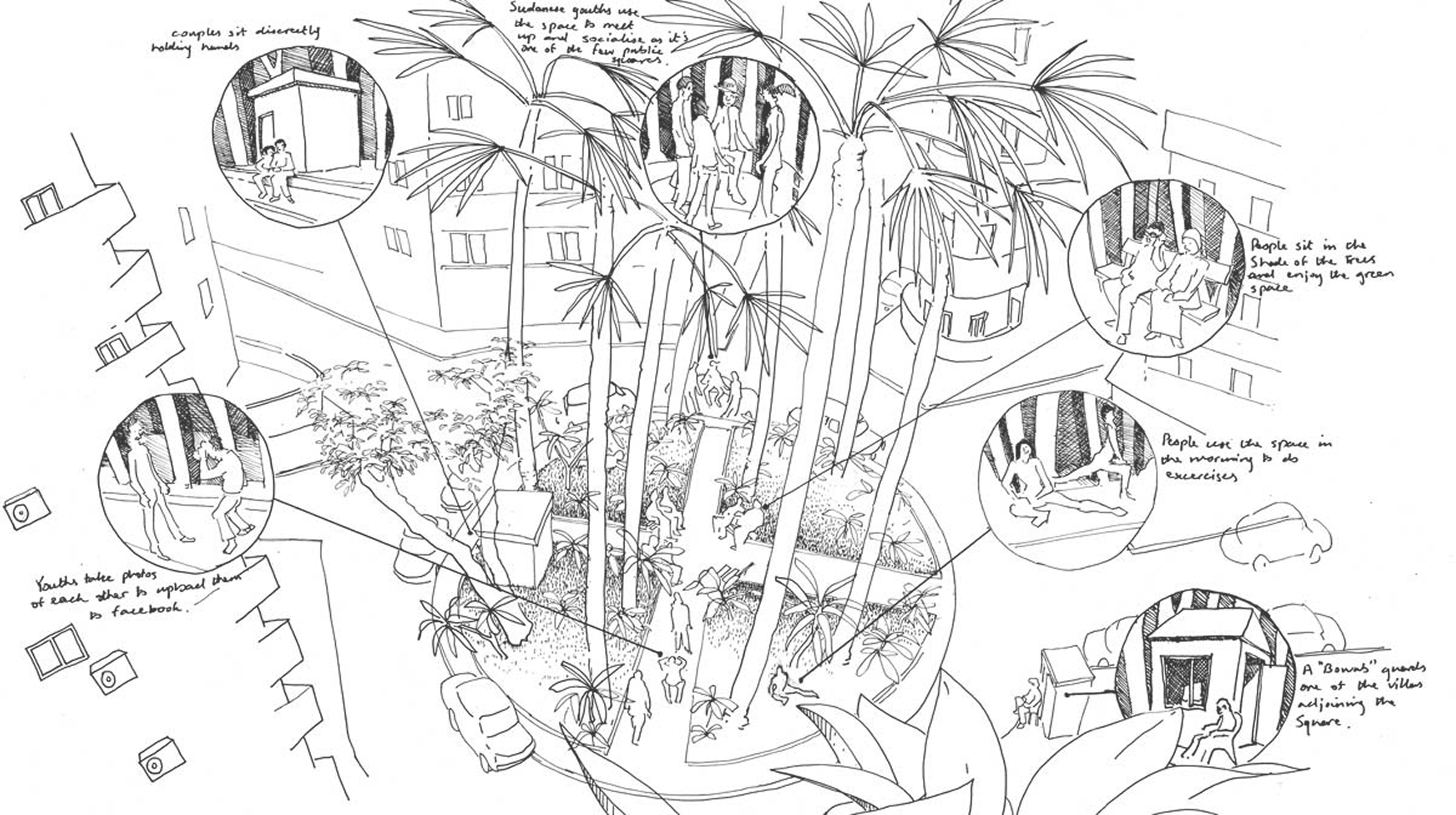
illustration: peter blodau
a profound mistrust defines the relationship between the governing power and the public space. the inhabitants of cairo navigate this friction daily. public space is rarely a freely accessible common ground; it is continuously negotiated, informally claimed, and sometimes abruptly retracted. our observations reveal how citizens subtly bypass official restrictions, utilizing micro-routines to create temporary zones of social autonomy.
text, photos: salma khaled, darius gondor
illustration: blodau peter
cairo city collective — operational unit
> darius gondor — research
> salma khaled — research & cultural insider
> emanuele campagna — visuals & video
> [redacted for security] — architecture
> [redacted for security] — art
> [redacted for security] — sound & music
a global directive. initiated by ruedi baur, the "places in relation" framework was established to decode the fragmented spatial realities of modern societies. the operational stage: the centre pompidou in paris.
selected as part of a specialized network of international research groups, we were invited to inject our analytical baseline into the exhibition. the mandate was clear. no theoretical urban planning. instead, a deep dissection of informal architectures and bottom-up structures operating under extreme systemic pressure.
our dedicated research field for this global initiative: the hyper-complex spatial dynamics of cairo.
the local framework conditions formed the absolute baseline of this investigation. to gather valid data within the real urban space, conventional, visible research methodologies were discarded in favor of an adaptive protocol:
the "smart city" concept is a trap. it widens the gap between hyperconnected centers and the periphery, where urbanity dissolves into vague contours. over half of cairo's population exists in conditions that are completely detached from formal urban planning. this reality demands an entirely new spatial strategy.
the traditional focus on historic nodes like downtown cairo or tahrir square is obsolete. true urban dynamics happen in the discarded, informal micro-centers that have organically structured their own populations.
to decode this hybrid character, the research isolated five specific locations, selected purely based on their systemic relation to one another.
the extreme socioeconomic friction has generated a specific architectural prototype: the segregated green city, engineered on the outskirts. around these artificial utopias, highly functional secondary nodes erupt organically—syrian markets, sports facilities, commercial zones. for every wealthy, isolated center, a parallel, underprivileged center forms its shadow. this continuous human friction is not just a side effect; it is the actual operating system of the city. mapping these informal spaces and exposing their physical exchanges is the baseline for resolving the complexity.
cairo is not a centralized grid. it is a highly complex, decentralized network of autonomous spaces that dictate the survival and culture of specific populations.
map: cairo city collective (cccc)
the square functions as a highly sensitive indicator of social stratification. analysis of the usage patterns reveals a fragmented operating mode that fluctuates throughout the day:
illustration: peter blodau
a profound mistrust defines the relationship between the governing power and the public space. the inhabitants of cairo navigate this friction daily. public space is rarely a freely accessible common ground; it is continuously negotiated, informally claimed, and sometimes abruptly retracted. our observations reveal how citizens subtly bypass official restrictions, utilizing micro-routines to create temporary zones of social autonomy.

spatial & cultural systems

spatial & cultural systems

